IGMAS+ Release v1.4.8707
Release notes
 IGMAS+ Release v1.4.8707
Overview
With our new release we extend the visualisation capabilities of IGMAS+ and add a couple of useful features.
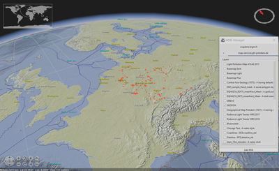
In the WorldWind Plugin is possible to use the data from the WMS service of GFZ Potsdam, which is added there by default:
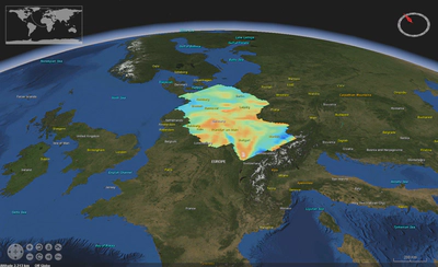
Apart from that, one can import and visualise local KML or KMZ files, e.g. point-wise data or images:
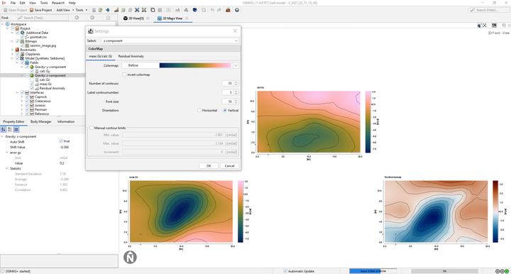
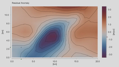
The new release includes reversed versions of all the 28 scientific colour maps. Along with new manual contour settings, adjustable font sizes and colour bar settings, these changes improve the user experience and help to analyse the variability of measured and calculated potential fields and their residuals.
List of changes
Added
- An option to change the font size of the axes and colour bars in 2D Map View
- Reversed colour maps from the scientific colour map set
- An option to set up manually the limits and the step of isolines or contours
- An option to set up the colour bar position
- A possibility to load local KML/KMZ files in the WorldWind plugin
- An option in the object tree to show/hide fields in different views
- An option to remove the components and fields
- Added a WMS service (in the WorldWind plugin) by GFZ Potsdam based on maps.gfz-potsdam.de
Changed
- Flatlaf updated to 1.1.2
Fixed
- All visibility settings of calculated and measured fields are synchronised for comparability
- By default the colour bar for each field in 2D Maps View is placed horizontally below each panel
- Rounding of the contour (isoline) labels
- Adjustment of colour bar position in 2D Maps View
- Sorting and storing of the list of model parameters in body manager
Download
Download this release from repository or from the archive.